

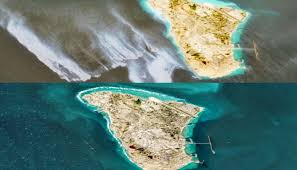
Kharg, May 11: A huge oil slick covering more than 20 square miles (about 45 to 71 square kilometers) has been detected through satellite images off the west coast of Kharg Island, a major crude oil export hub of Iran.
Key details of the oil spill:
Estimated size: According to global oil spill monitoring firm Orbital EOS, more than 3,000 barrels of crude oil have leaked into the Persian Gulf. According to some independent tracking firms, its size could affect the entire waterway.
How was it detected?: The European Space Agency’s Copernicus Sentinel satellites first captured the leak between May 5 and May 8, 2026.
Movement: The oil slick is about 45 kilometers long and is moving southeast/southeast towards the waters of Saudi Arabia and Qatar. It is causing major concerns for desalination plants, fisheries and sensitive aquatic ecosystems in the area.
Root causes and pressure on infrastructure
Although the exact cause is still unknown from official sources, marine and energy analysts are pointing to severe systemic pressure on Iran’s energy network.
Storage capacity constraints: The blockade has left hundreds of oil tankers stranded in the Gulf, unable to move further. As a result, Iran’s The crude oil storage facilities on Kharg Island, which handle 90 percent of Iran’s oil exports, have reached their maximum capacity.
Pressure on pipelines: Oil wells and old undersea pipelines (like the one at the nearby Abu Dhabi oil field) cannot be easily shut down or shut down. This makes it more likely that the pipelines will burst due to high pressure or leak oil due to technical faults.
Neither Iran’s Foreign Ministry nor its state media have made any public statement about the oil spill, nor have they confirmed any urgent clean-up efforts. Meanwhile, secret diplomatic talks are reportedly underway through intermediaries in Islamabad to lift the naval blockade.